I opened my Air Control app to request LAANC (low altitude authorization and notification capability—I talk about this app in one of my “Day in the Life” blog posts) and saw an ominous red band along the border. On my map it covers nearly all of San Ysidro and a big slice of Otay Mesa—two communities snuggled up against the border wall.
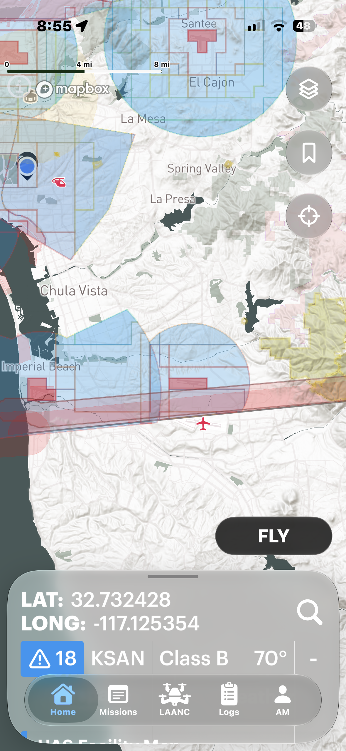
Screenshot from the Air Control iOS app (10/26/26) showing the new U.S./Mexico border drone exclusion zone.
That is the new border drone restriction. If you fly recreationally or commercially in South Bay, it changes how you plan, and, in some cases how you work (or don’t).
What the NOTAM says
First, for non-pilots, a NOTAM is a “Notice to Airmen.” It’s a basic last-minute advisory for anybody involved in flight operations. It can be boring like “that runway is under repair” or “there’s a crane over there, so be careful” or more exciting like “the Super Bowl is happening so don’t fly near the stadium.”
This one hits closer to home, and is more than a little intrusive (and, frankly, punitive). Government agencies, including the FAA and DHS, announced this new restriction on October 16, 2026. The FAA NOTAM, FDC 6/9954, runs October 19, 2026 to October 19, 2027. I’m linking to it, but the short version says it prohibits all drone operations within one nautical mile inland of the border, from the surface to 400 feet AGL. That is about 1.15 statute (“normal”) miles. 400 feet is also the Part 107 ceiling. So flying lower does not keep you out. The same NOTAM covers the whole California/Arizona/NM border, including Calexico and Imperial County, and extends all the way to the Gulf Coast of Texas.
Who gets in
The NOTAM allows Customs and Border Protection (CBP) to only approve flights that directly support national defense, homeland security, law enforcement, firefighting, medevac, search and rescue, or disaster response. It also mentions flights in support of “event ops.”
This is what effects me (and maybe you?): commercial work is not on the list. The NOTAM does not define “event ops.” It says flights “may be authorized,” not that they will be.
To request an exemption, I have to email CBP at least 48 hours ahead. They want my name, FAA certifications, phone number, flight date, time and location, and your drone’s Remote ID, make, model and serial number. This, to me, is one of the irksome parts: FAA controls airspace, not CBP or DHS. Oh, and most commercial drones broadcast RID information, so any agency employee with the right tech can see who I am within broadcast range. And use new tech to “shoot down” or jam offending drones.
What happens if you fly anyway
The NOTAM calls this “national defense airspace.” Pilots who ignore it may be “intercepted and detained” (FAA/DHS language). The FAA may impose civil penalties (fines) and suspend or revoke my certificate. The government may actually pursue criminal charges. The NOTAM also says “deadly force” may be used against an aircraft judged to be an imminent security threat. But for a working pilot, losing my certificate is realistically the number one risk.
Why it’s happening
The government cites cartel drug drones (dropping small packages over the border wall) as the impetus for this blather (never mind that the cartels also use cars and trucks and tunnels and airplanes and people). The U.S. military counted 378 incursions (into U.S. territory) in 30 days between August and September 2026. Mexico also ran an anti-drone operation near Mesa de Otay, with 800 federal troops covering a five-kilometer stretch. This is all part of a bigger buildout. Interestingly, DHS granted 12 companies (who they are friends with?) spots on a “counter-drone” contract worth up to $1.5 billion in August 2026.
The numbers are hard to read because the CBP count of 37,000 “near-border flights” is obviously not a count of cartel drones. There is a ton of construction near and at the border, people living there, and—surprise—drone operators.
Why Otay Mesa is important
A 2023 CBRE brief said the most construction in the San Diego market was in Otay Mesa. Otay Business Park (i’ve been there—it’s enormous) covers 119 acres along the border. Another project is a 1,080,000-square-foot distribution center on a 72-acre site. The people marketing these complexes hire people like me to photograph the construction progress and the final product.
Imperial Country uses a lot of big agricultural drones (sprayers). Those near the border are now effectively grounded.
Who else is affected?
It’s not just San Diego. In El Paso, Texas, the restriction reaches downtown plazas and most of UTEP. Local pilots say it is going to kill much of their work.
So what I am changing? I’ve got a client building school sports complexes within shouting distant of this new “thin red line.” So I need to measure every site against the line first, re-check NOTAMs on shoot day, make aerial deliverables conditional on airspace status, and manage expectations. If your project is nea the border, you (my client) might no longer have access to aerial images while this TFR temporary flight restriction) is in place. Here is the U.S. release about the TFR.
What I still want to know
The wording is very vague (purposely?)… what does CBP count as “event ops”? Have any commercial operators been approved for an exemption? How are other drone operators handling sites near the border?